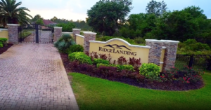
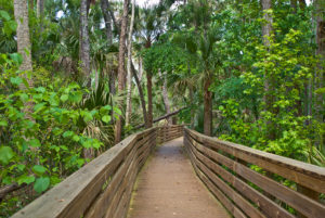
Hello Aviators! Todays destination is Crystal River and the Plantation Inn Golf Resort. This is a great place to drop in for brunch. The restaurant, which is located to the back of the Inn, has wonderful views of the gazebo, gardens, pool and river. The inn is just a couple miles from the airport and can be walked, but if you call they will pick you up. The grounds of Plantation Inn are very well manicured and the buildings stately. I apologize, but at this time we have no information to add regarding lodging or golf. We hope to get back soon to spend a weekend and discover all this west coast oasis has to offer. The food was really good, the service was excellent and the facility was nicely decorated. The atmosphere was likewise very pleasant and unhurried. And the price moderate, if I recall, around $20 per person. This place is a keeper…. When you need a sure thing, this is the place to visit. Did I mention you can swim with and feed manatee’s!!


Crystal River Airport Information
Location
| FAA Identifier: | CGC |
| Lat/Long: | 28-52-03.4000N / 082-34-26.8000W 28-52.056667N / 082-34.446667W 28.8676111 / -82.5741111 (estimated) |
| Elevation: | 8.9 ft. / 2.7 m (surveyed) |
| Variation: | 05W (2010) |
| From city: | 3 miles SE of CRYSTAL RIVER, FL |
| Time zone: | UTC -4 (UTC -5 during Standard Time) |
| Zip code: | 34429 |
Airport Operations
| Airport use: | Open to the public |
| Activation date: | 04/1940 |
| Sectional chart: | JACKSONVILLE |
| Control tower: | no |
| ARTCC: | JACKSONVILLE CENTER |
| FSS: | SAINT PETERSBURG FLIGHT SERVICE STATION |
| NOTAMs facility: | CGC (NOTAM-D service available) |
| Attendance: | 0700-1900 |
| Wind indicator: | lighted |
| Segmented circle: | yes |
| Lights: | ACTVT MIRL RY 09/27, REIL RY 09, 27 – CTAF. |
| Beacon: | white-green (lighted land airport) Operates sunset to sunrise. |
Airport Communications
| CTAF/UNICOM: | 122.725 |
| WX AWOS-3: | 118.325 (352-563-6600) |
| JACKSONVILLE APPROACH: | 118.6 |
| JACKSONVILLE DEPARTURE: | 118.6 |
| WX AWOS-3 at INF (14 nm E): | 119.975 (352-341-0264) |
Nearby radio navigation aids
| VOR radial/distance | VOR name | Freq | Var | |||
|---|---|---|---|---|---|---|
| OCFr224/26.0 | OCALA VORTAC | 113.70 | 00E |
Airport Services
| Fuel available: | 100LL JET-A |
| Parking: | tiedowns |
| Airframe service: | MINOR |
| Powerplant service: | MINOR |
| Bottled oxygen: | NONE |
| Bulk oxygen: | NONE |
Runway Information
Runway 9/27
| Dimensions: | 4557 x 75 ft. / 1389 x 23 m | ||
| Surface: | asphalt, in good condition | ||
| Runway edge lights: | medium intensity | ||
| RUNWAY 9 | RUNWAY 27 | ||
| Latitude: | 28-52.038235N | 28-52.031545N | |
| Longitude: | 082-34.705598W | 082-33.851877W | |
| Elevation: | 6.6 ft. | 7.8 ft. | |
| Gradient: | 0.1% | 0.1% | |
| Traffic pattern: | left | left | |
| Runway heading: | 096 magnetic, 091 true | 276 magnetic, 271 true | |
| Markings: | nonprecision, in good condition | nonprecision, in good condition | |
| Visual slope indicator: | 2-light PAPI on left (3.00 degrees glide path) | 2-light PAPI on right (3.00 degrees glide path) | |
| Runway end identifier lights: | yes | yes | |
| Touchdown point: | yes, no lights | yes, no lights | |
| Obstructions: | 15 ft. road, 395 ft. from runway, 13:1 slope to clear APCH SLOPE 26:1 TO EOR. |
15 ft. road, 350 ft. from runway, 10:1 slope to clear APCH SLOPE 23:1 TO EOR. |
|
Runway 18/36
| Dimensions: | 2666 x 100 ft. / 813 x 30 m | ||
| Surface: | turf, in good condition | ||
| Runway edge markings: | 18/36 MKD WITH WHITE PIPES EVERY 200 FT. | ||
| RUNWAY 18 | RUNWAY 36 | ||
| Latitude: | 28-52.315840N | 28-51.875858N | |
| Longitude: | 082-34.733695W | 082-34.732702W | |
| Elevation: | 6.1 ft. | 5.7 ft. | |
| Gradient: | 0.1% | 0.1% | |
| Traffic pattern: | left | left | |
| Runway heading: | 185 magnetic, 180 true | 005 magnetic, 360 true | |
| Displaced threshold: | 192 ft. 18/36 DSPLCD THRS MKD WITH GREEN PIPES. BLDGS & FENCE 40 FT FROM CNTRLN BOTH SIDES OF DSPLCD THLD. |
819 ft. | |
| Touchdown point: | yes, no lights | yes, no lights | |
| Obstructions: | 14 ft. bldg, 92 ft. from runway, 65 ft. right of centerline, 6:1 slope to clear RY 18, APCH RATIO 20:1 TO DSPLCD THLD; 16 FT BLDG 137 FT, 70 FT R. |
6 ft. fence, 38 ft. from runway, 6:1 slope to clear RY 36 APCH RATIO 20:1 TO DSPLCD THLD; 62 FT TREES 428 FT 0B. |
|
Airport Ownership and Management from official FAA records
| Ownership: | Publicly-owned | ||||||||||||||||
| Owner: | CITRUS COUNTY 110 NORTH APOPKA AVE INVERNESS, FL 34450 Phone 352-637-9400 CONTACT PERSON: QUINCY WYLUPEK 3600 WEST SOVEREIGN PATH, SUITE 241, LACANTO FL, 34461 352-527-5488 FAX; 352-527-5482 |
||||||||||||||||
| Manager: | THOMAS DAVIS PO BOX 2050 CRYSTAL RIVER, FL 34423 Phone 352-795-6868 AIRPORT PHYSICAL ADDRESS: 718 NORTH LINDBERGH DRIVE, CRYSTAL RIVER, FL 34429 352-795-6868 FAX: 352-795-1730
|