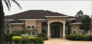
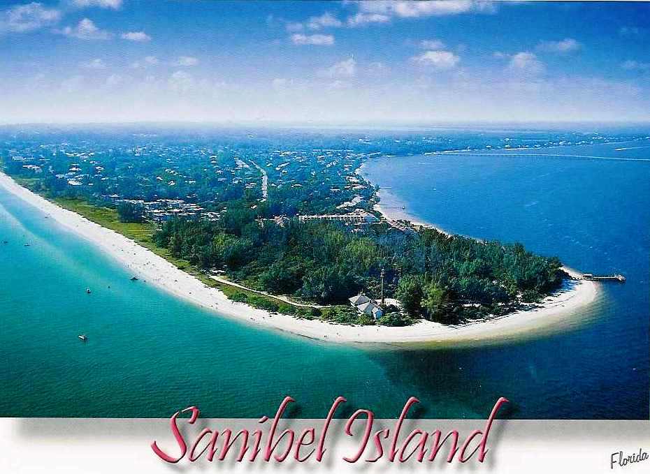
Hello Aviators! Have you ever… dreamed of being on a tropical island, your toes in the soft white sand, an expansive beach, swaying coconut palms, lush tropical foliage and beautiful crystal blue water. Imagine watching the pelicans and herons fish for their dinner, collecting “treasures from the sea,” pastel colored seashells, while the sandpipers scurry along the surfs edge. Sanibel Island has everything one could wish for…excellent restaurants, accommodations, golfing, tennis, fishing, boating, shopping, bike paths, canoes, theatrical productions, the renowned J.N. “Ding Darling” National Wildlife Refuge & Bird Sanctuary. Since 1884 Point Ybel Lighthouse has guided seafarers to Sanibel Island’s shores.

![]()
Paul Tritaik, Refuge Manager
1 Wildlife Drive
Sanibel, FL 33957
Phone: (239) 472-1100
Fax: (239) 472-4061
Email: dingdarling@fws.gov
The J. N. “Ding” Darling National Wildlife Refuge is located on the subtropical barrier island of Sanibel in the Gulf of Mexico. The refuge is part of the largest undeveloped mangrove ecosystem in the United States. It is world famous for its spectacular migratory bird populations
Car Rentals
Hertz Rent a Car
Enterprise Rent-A-Car
17811 San Carlos Boulevard, Ft Myers Beach, FL
19011 San Carlos Boulevard, Fort Myers Beach, FL ]
(239) 463-2122
| KRSW | Southwest Florida International Airport Fort Myers, Florida, USA |
FAA INFORMATION EFFECTIVE 15 NOVEMBER 2012
Location
| FAA Identifier: | RSW |
| Lat/Long: | 26-32-10.2000N / 081-45-18.6000W 26-32.170000N / 081-45.310000W 26.5361667 / -81.7551667 (estimated) |
| Elevation: | 30 ft. / 9.1 m (surveyed) |
| Variation: | 04W (2000) |
| From city: | 10 miles SE of FORT MYERS, FL |
| Time zone: | UTC -5 (UTC -4 during Daylight Saving Time) |
| Zip code: | 33913 |
Airport Operations
| Airport use: | Open to the public |
| Activation date: | 03/1983 |
| Sectional chart: | MIAMI |
| Control tower: | yes |
| ARTCC: | MIAMI CENTER |
| FSS: | MIAMI FLIGHT SERVICE STATION |
| NOTAMs facility: | RSW (NOTAM-D service available) |
| Attendance: | CONTINUOUS |
| Wind indicator: | lighted |
| Segmented circle: | yes |
| Lights: | ACTVT MALSR RY 06 – CTAF. ALL OTHER LIGHTS OPERATE CONTINUOUSLY. |
| Beacon: | white-green (lighted land airport) Operates sunset to sunrise. |
| Landing fee: | yes, FEES FOR ALL CHARTER AND TRAVEL CLUBS AND REVENUE PRODUCING ACFT. |
| Fire and rescue: | ARFF index D |
| Airline operations: | CLSD TO UNSKED ACR OPNS WITH MORE THAN 30 PSGR SEATS EXCP PPR CALL AMGR (239) 590-4810. |
| International operations: | customs landing rights airport US CUSTOMS USER FEE ARPT. US CUSTOMS USER FEE ARPT. |
Airport Communications
| CTAF/UNICOM: | 122.95 |
| ATIS: | 124.65 |
| WX ASOS: | PHONE 239-561-0966 |
| FORT MYERS GROUND: | 121.9 348.6 [0600-0000] |
| FORT MYERS TOWER: | 128.75 257.8 [0600-0000] |
| FORT MYERS APPROACH: | 119.75(060-240) 125.15(241-330) 126.8(331-059) 306.2(241-330) 327.8(060-240) 343.75(331-059) [0600-0000] |
| FORT MYERS DEPARTURE: | 119.75(060-240) 125.15(241-330) 126.8(331-059) 306.2(241-330) 327.8(060-240) 343.75(331-059) [0600-0000] |
| CLEARANCE DELIVERY: | 132.075 |
| CLASS C: | 119.75(060-240) 125.15(241-330) 306.2(241-330) 327.8(060-240) |
| CLASS C IC: | 126.8(331-059) 343.75(331-059) |
| WX ASOS at FMY (7 nm NW): | PHONE 239-936-2318 |
| WX AWOS-3 at IMM (20 nm E): | 118.525 (239-657-2038) |
- APCH/DEP SVC PRVDD BY MIAMI ARTCC ON FREQS 134.75/322.5 (FORT MYERS RCAG) WHEN FORT MYERS APCH CTL CLSD.
- WHEN ATCT CLSD LAWRS AVBL ON FREQ 122.95.
Nearby radio navigation aids
| VOR radial/distance | VOR name | Freq | Var | |||
|---|---|---|---|---|---|---|
| RSWr073/1.2 | LEE COUNTY VORTAC | 111.80 | 02W | |||
| CYYr006/23.0 | CYPRESS VOR/DME | 108.60 | 03W | |||
| PGDr154/(26.1) | PUNTA GORDA VOR | 110.20 | 03W | |||
| LBVr227/26.2 | LA BELLE VORTAC | 110.40 | 01E |
| NDB name | Hdg/Dist | Freq | Var | ID | |||||
|---|---|---|---|---|---|---|---|---|---|
| NAPLES | 006/22.9 | 201 | 03W | APF | .- .–. ..-. | ||||
Airport Services
| Fuel available: | 100LL JET-A |
| Parking: | hangars and tiedowns |
| Airframe service: | MAJOR |
| Powerplant service: | MAJOR |
| Bottled oxygen: | HIGH/LOW |
| Bulk oxygen: | HIGH/LOW |
Runway Information
Runway 6/24
| Dimensions: | 12000 x 150 ft. / 3658 x 46 m | ||||||||||
| Surface: | asphalt/grooved, in good condition | ||||||||||
| Weight bearing capacity: |
|
||||||||||
| Runway edge lights: | high intensity | ||||||||||
| RUNWAY 6 | RUNWAY 24 | ||||||||||
| Latitude: | 26-31.589113N | 26-32.750393N | |||||||||
| Longitude: | 081-46.201155W | 081-44.417242W | |||||||||
| Elevation: | 26.5 ft. | 29.7 ft. | |||||||||
| Traffic pattern: | right | left | |||||||||
| Runway heading: | 058 magnetic, 054 true | 238 magnetic, 234 true | |||||||||
| Markings: | precision, in good condition | precision, in good condition | |||||||||
| Visual slope indicator: | 4-box VASI on left (3.00 degrees glide path) | 4-light PAPI on left (3.00 degrees glide path) | |||||||||
| RVR equipment: | touchdown | ||||||||||
| Approach lights: | MALSR: 1,400 foot medium intensity approach lighting system with runway alignment indicator lights | ||||||||||
| Runway end identifier lights: | yes | ||||||||||
| Centerline lights: | yes | yes | |||||||||
| Touchdown point: | yes, lighted | yes, no lights | |||||||||
| Instrument approach: | ILS | ||||||||||
Airport Ownership and Management from official FAA records
| Ownership: | Publicly-owned |
| Owner: | BOARD OF COM LEE CO PORT AUTH PO BOX 398 FORT MYERS, FL 33902 Phone 239-590-4800 |
| Manager: | ROBERT M. BALL 11000 TERMINAL ACCESS RD. FORT MYERS, FL 33913 Phone 239–590-4800 |