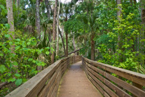
Hello Aviators! Silver Springs, a beautiful park in Ocala famous for the pure spring water of the Silver River. These springs produce over 500 million gallons of clear water each day! Visitors can spend hours exploring the river’s wildlife attractions by walking along riverbank trails or taking glass bottom boat tours, which offer nearly perfect views into the river’s ecosystem below. The park also provides opportunities to catch glimpses of rare animals in its many wildlife exhibits, which feature species ranging from white alligators and native snakes to cougars and black bears. Other activities you can enjoy include exploring the park’s botanical gardens, children’s petting zoo, and wilderness shows.
5656 East Silver Springs Boulevard
Silver Springs, FL 34488
(352) 236-2121

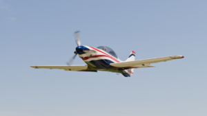
Airport Information
Ocala International Airport is a city-owned public-use airport located four nautical miles west of the central business district of Ocala, a city in Marion County, Florida, United States.
FAA INFORMATION EFFECTIVE 15 NOVEMBER 2012
Location
| FAA Identifier: | OCF |
| Lat/Long: | 29-10-18.7564N / 082-13-26.8127W 29-10.312607N / 082-13.446878W 29.1718768 / -82.2241146 (estimated) |
| Elevation: | 90 ft. / 27.4 m (surveyed) |
| Variation: | 04W (2000) |
| From city: | 4 miles W of OCALA, FL |
| Time zone: | UTC -5 (UTC -4 during Daylight Saving Time) |
| Zip code: | 34474 |
Airport Operations
| Airport use: | Open to the public |
| Activation date: | 08/1961 |
| Sectional chart: | JACKSONVILLE |
| Control tower: | yes |
| ARTCC: | JACKSONVILLE CENTER |
| FSS: | GAINESVILLE FLIGHT SERVICE STATION |
| NOTAMs facility: | OCF (NOTAM-D service available) |
| Attendance: | 0600-2100 FOR ATTENDANT AFTER HRS CALL 352-629-8217. |
| Wind indicator: | lighted, SS-SR. |
| Segmented circle: | yes |
| Lights: | WHEN ATCT CLSD, ACTVT MALSR RY 36, PAPI RY 18, HIRL RY 18/36 – CTAF. PAPI RY 36 OPER SS-SR. |
| Beacon: | white-green (lighted land airport) Operates sunset to sunrise. |
| Fire and rescue: | ARFF index A |
| Airline operations: | CLSD TO ACR OPNS WITH MORE THAN 30 PSGR SEATS EXCP 24 HRS PPR CALL AIRPORT MANAGER (352) 629-8377. |
Airport Communications
| CTAF: | 119.25 |
| UNICOM: | 123.0 |
| ATIS: | 128.125 |
| WX AWOS-3: | 128.125 (352-237-8525) |
| OCALA GROUND: | 121.4 [0700-2000] |
| OCALA TOWER: | 119.25 [0700-2000] |
| JACKSONVILLE APPROACH: | 118.6 |
| JACKSONVILLE DEPARTURE: | 118.6 |
| CTL: | 121.4 |
| WX AWOS-3 at X60 (17 nm NW): | 118.425 (352-528-9949) |
Nearby radio navigation aids
| VOR radial/distance | VOR name | Freq | Var | |||
|---|---|---|---|---|---|---|
| OCF at field | OCALA VORTAC | 113.70 | 00E | |||
| GNVr179/31.3 | GATORS VORTAC | 116.20 | 04W |
| NDB name | Hdg/Dist | Freq | Var | ID | |||||
|---|---|---|---|---|---|---|---|---|---|
| LEESBURG | 318/30.5 | 335 | 04W | LEE | .-.. . . | ||||
| PALATKA | 222/36.0 | 243 | 05W | IAK | .. .- -.- | ||||
Airport Services
| Fuel available: | 100LL JET-A1+ |
| Parking: | hangars and tiedowns |
| Airframe service: | MAJOR |
| Powerplant service: | MAJOR |
| Bottled oxygen: | HIGH |
| Bulk oxygen: | HIGH/LOW |
Runway Information
Runway 18/36
| Dimensions: | 7467 x 150 ft. / 2276 x 46 m | ||||||||
| Surface: | asphalt/grooved, in excellent condition | ||||||||
| Weight bearing capacity: |
|
||||||||
| Runway edge lights: | high intensity | ||||||||
| RUNWAY 18 | RUNWAY 36 | ||||||||
| Latitude: | 29-10.729363N | 29-09.497208N | |||||||
| Longitude: | 082-13.383650W | 082-13.382032W | |||||||
| Elevation: | 80.1 ft. | 78.0 ft. | |||||||
| Gradient: | UP | UPDOWN | |||||||
| Traffic pattern: | left | left | |||||||
| Runway heading: | 184 magnetic, 180 true | 004 magnetic, 360 true | |||||||
| Displaced threshold: | 160 ft. | 561 ft. | |||||||
| Declared distances: | TORA:7467 TODA:7467 ASDA:6907 LDA:6747 | TORA:7467 TODA:7467 ASDA:6907 LDA:6347 | |||||||
| Markings: | nonprecision, in good condition | precision, in good condition | |||||||
| Visual slope indicator: | 4-light PAPI on left (3.00 degrees glide path) | 4-light PAPI on left (3.00 degrees glide path) | |||||||
| Approach lights: | MALSR: 1,400 foot medium intensity approach lighting system with runway alignment indicator lights | ||||||||
| Touchdown point: | yes, no lights | yes, no lights | |||||||
| Instrument approach: | ILS | ||||||||
| Obstructions: | 60 ft. trees, 2600 ft. from runway, 40:1 slope to clear | none | |||||||
Runway 8/26
| Dimensions: | 3009 x 50 ft. / 917 x 15 m | ||||
| Surface: | asphalt, in good condition | ||||
| Weight bearing capacity: |
|
||||
| RUNWAY 8 | RUNWAY 26 | ||||
| Latitude: | 29-10.763863N | 29-10.850597N | |||
| Longitude: | 082-13.884353W | 082-13.327232W | |||
| Elevation: | 86.9 ft. | 87.8 ft. | |||
| Gradient: | UPDOWNDOWN | UPDOWNDOWNUP | |||
| Traffic pattern: | left | left | |||
| Runway heading: | 084 magnetic, 080 true | 264 magnetic, 260 true | |||
| Markings: | basic, in fair condition | basic, in fair condition | |||
| Touchdown point: | yes, no lights | yes, no lights | |||
| Obstructions: | 45 ft. trees, 1300 ft. from runway, 250 ft. right of centerline, 24:1 slope to clear | 29 ft. pline, 1200 ft. from runway, 300 ft. right of centerline, 34:1 slope to clear | |||
Airport Ownership and Management from official FAA records
| Ownership: | Publicly-owned |
| Owner: | CITY OF OCALA 750 SW 60TH AVENUE OCALA, FL 34474 Phone 352-629-8377 |
| Manager: | MR. MATTHEW GROW 750 SW 60TH AVE OCALA, FL 34474 Phone 352-629-8377 CELL: 352-427-5737 |
Airport Operational Statistics
|
|
||||||||||||||||||||||||||||||||
Directions From Ocala International Airport to Silver Springs
Turn Left onto SW 60th Ave.
Drive 1.0 mile turn right onto fl-40
Drive 11.0 miles then turn right onto NE 55th Ave. Destination will be on your right.