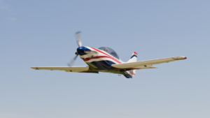
Hello Aviators ! todays day trip is to cedar Key and Flying fish air boat adventures you may, discover that you need to “go somewhere!” or on a “Daycation” this is your spot covered in natural beauty and jammed pack with fun and adventurous things to do. Flying Fish airboat tours will stop at nothing to show you nothing but an amazing time
Fishing and boating are not only recreational in Cedar Key, but they are a way of life. Cedar Key is a part of Florida’s Big Bend, an area known for its excellent sports fishing. Inshore and offshore fishing are popular amongst seasoned fisherpersons as well as novices trying their luck for the first time. Be sure to experience the up close adventures of kayaking along our shorelines and explore some of the many small keys.
Flying Fish Airboat Adventures
302 Dock Street Dock #3
Cedar Key, FL 32625
352-278-4295

FAAINFORMATION EFFECTIVE 20 SEPTEMBER 2012
Location
FAA Identifier: CDK
Lat/Long: 29-08-03.2000N / 083-03-01.7000W
29-08.053333N / 083-03.028333W
29.1342222 / -83.0504722
(estimated)
Elevation: 11 ft. / 3.4 m (surveyed)
Variation: 02W (1985)
From city: 1 mile W of CEDAR KEY, FL
Time zone: UTC -4 (UTC -5 during Standard Time)
Zip code: 32625
Airport Operations
Airport use: Open to the public
Activation date: 04/1940
Sectional chart: JACKSONVILLE
Control tower: no
ARTCC: JACKSONVILLE CENTER
FSS: GAINESVILLE FLIGHT SERVICE STATION
NOTAMs facility: GNV (NOTAM-D service available)
Attendance: UNATNDD
Wind indicator: lighted, WINDSOCK ON NON-FRANGIBLE POLE.
Segmented circle: yes
Lights: ACTVT MIRL RY 05/23 – CTAF.
Beacon: white-green (lighted land airport)
ARPT BCN OTS INDEFLY. Operates sunset to sunrise.
Airport Communications
CTAF: 122.9
Nearby radio navigation aids
VOR radial/distance VOR name Freq Var
CTYr182/27.9 CROSS CITY VORTAC 112.00 02W
Airport Services
Parking: tiedowns
Airframe service: NONE
Powerplant service: NONE
Bottled oxygen: NONE
Bulk oxygen: NONE
Runway Information
Runway 5/23
Dimensions: 2355 x 100 ft. / 718 x 30 m
Surface: asphalt, in fair condition
Weight bearing capacity:
Single wheel: 12.5
Runway edge lights: medium intensity
Runway edge markings: RY 05/23 MARKINGS FADED.
RUNWAY 5 RUNWAY 23
Latitude: 29-07.924833N 29-08.182333N
Longitude: 083-03.194667W 083-02.863000W
Gradient: 0.2% 0.2%
Traffic pattern: left left
Displaced threshold: no 338 ft.
Markings: NSTD, in poor condition NSTD, in poor condition
Visual slope indicator: 2-box VASI on left
Obstructions: none
RY 05 HAS +3 FT BUSH AT RY END. 15 ft. road, 200 ft. from runway
RY 23 HAS +2 FT BRUSH 15 FT ROAD AT END 0F RWY.
Airport Ownership and Management from official FAA records
Ownership: Publicly-owned
Owner: LEVY COUNTY
PO BOX 310
BRONSON, FL 32621
Phone 352-486-5218
CONTACT PERSON: FREDDY MOODY, 352-486-5216, FAX: 352-486-5167
Manager: FRED MOODY
GEORGE T LEWIS AIRPORT, PO BOX 310
BRONSON, FL 32621
Phone 352-486-5216
AIRPORT PHYSICAL ADDRESS: 14703 SOUTHWEST AIRPORT RD., CEDAR KEY, FL 32625
Airport Operational Statistics
Aircraft based on the field: 4
Single engine airplanes: 4
Aircraft operations: avg 77/week *
75% transient general aviation
25% local general aviation
* for 12-month period ending 08 February 2010
Additional Remarks
– SEA GULLS ON RY.
– TWY CLSD TO ACFT, USED AS PUBLIC ROAD.
– 4 FT FENCE 125 FT FM RY CENTERLINE LOCATED 400 FT ‘NE’ OF RY 23 THRLD & PARRALLEL TO PUBLIC ROAD.
Instrument Procedures
There are no published instrument procedures at KCDK.
Some nearby airports with instrument procedures:
KCGC – Crystal River Airport (30 nm SE)
KCTY – Cross City Airport (30 nm N)
X60 – Williston Municipal Airport (33 nm NE)
X35 – Marion County Airport (36 nm E)
KINF – Inverness Airport (43 nm SE)
